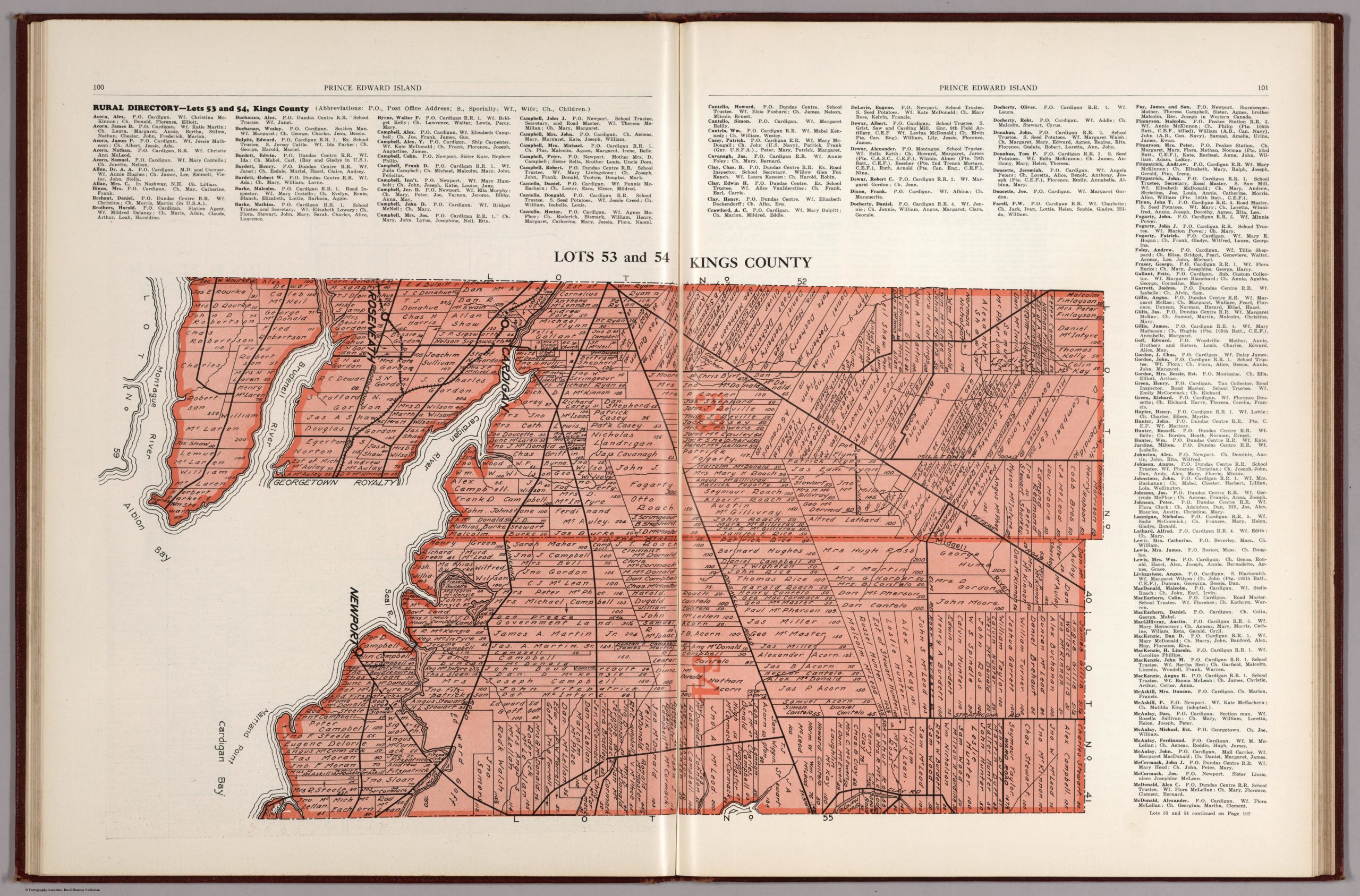
This is a very large (10MB) of Plan of Lots Fifty Three & Fifty Four, Kings Co., P.E.I from 1880 map. From the David Rumsey Map Collection.

Click image to enlarge.
Click image to enlarge.
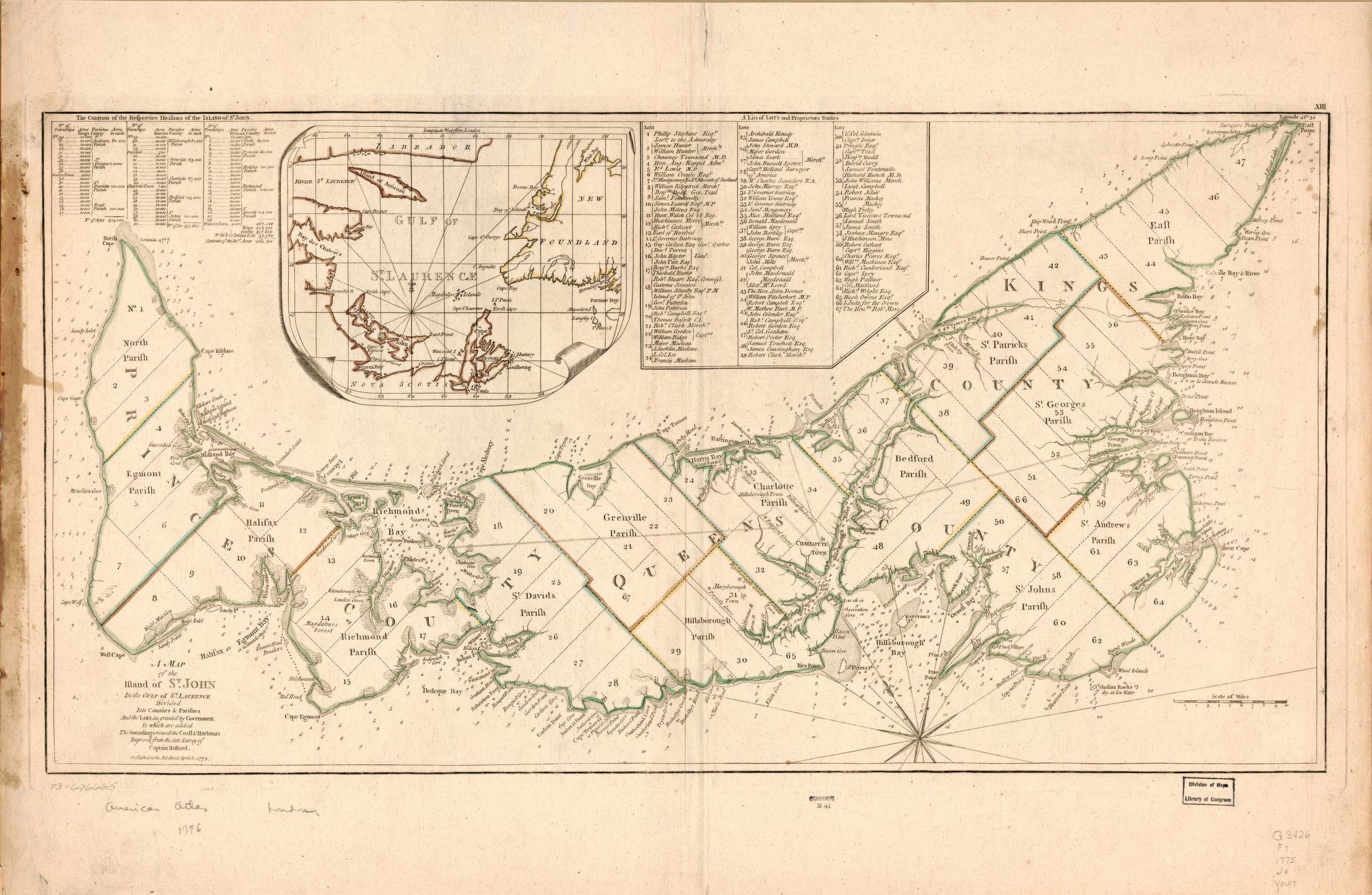
Click image to enlarge.
This is a very large (10MB) of Plan of Lots Fifty Three & Fifty Four, Kings Co., P.E.I from 1880 map. From the David Rumsey Map Collection.
Click image to enlarge.
Click image to enlarge.
Click image to enlarge.